


| Property | Value |
|---|---|
| Country of Origin (subject to change) | United States |
| Package Quantity | 1 |


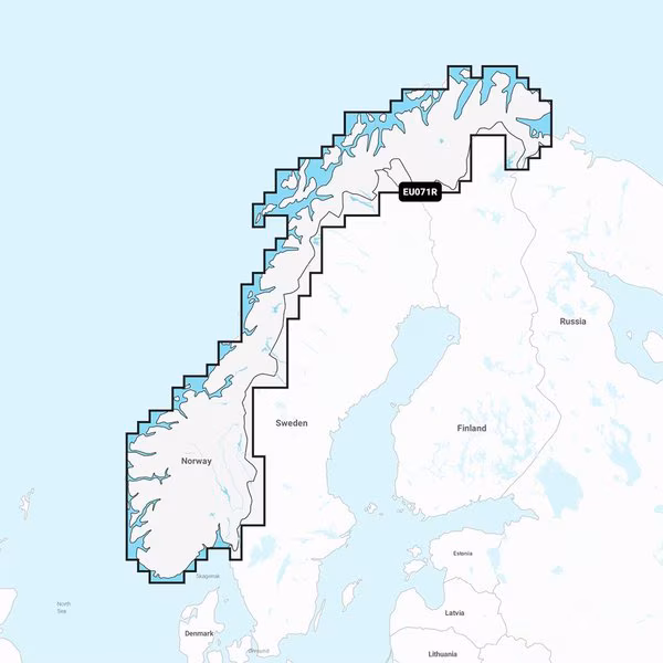
Navionics Vision+ NVEU071R, Norway, Lakes Rivers, Inland Marine Chart
$234,99
Free shipping will be applied on orders over $50
Navionics Vision+ NVEU071R - Norway, Lakes Rivers - Inland Marine Chart Get the world's No. 1 choice in the marine mapping with the best, most up-to-date Navionics+ cartography on your compatible chartplotter. Featuring vibrant colors, a streamlined interface and combined coastal/inland content with a popular Navionics style color palette, Garmin Navionics+ cartography makes it easy to plot your course. Multiple shading options aid in shallow water navigation and make it easy to highlight a target depth range for the best fishing spots. Fully customizable with various chart layers, overlay combinations and up to 10 color-shaded target depth ranges to scope out the best fishing spots. When you purchase a new Garmin Navionics+ or Garmin Navionics Vision+ cartography product, a one-year subscription is included. Chart Code - NVEU071R Coverage Area: Detailed coverage of the lakes and canals of Norway including Lake Mjøsa, Lake Bandak, Lake Kviteseidvatnet, Lake Flåvatn, Lake Norsjø, Lake Heddalsvatnet, the Telemark Canal and the Oslofjord. Features: All-in-one Map Solution - Access detail-rich mapping of coastal features, lakes, rivers and more. Integrated Garmin and Navionics content offers coverage for boaters worldwide. Daily Chart Updates - Charts are constantly being enhanced with new and amended content — as many as 5,000 updates are made every day. The one-year included subscription gives you access to daily chart updates via the ActiveCaptain app. Auto Guidance+ Technology - Combining the best of Garmin and Navionics automatic routing features, built-in Auto Guidance+ technology1 gives you a suggested dock-to-dock path to follow through channels, inlets, marina entrances and more. Depth Range Shading - High-resolution depth range shading lets you select up to 10 color-shaded options and view your designated target depths at a glance. Up to 1' Contours - For improved fishing and navigation, up to 1' contours provide a clear depiction of bottom structure for improved fishing charts and enhanced detail in swamps, canals, harbors, marinas and more. Shallow Water Shading - To give a clear picture of shallow waters to avoid, this feature allows for shading at a user-defined depth.&nb
Out of stock
You must be logged in to post a review.
Reviews
There are no reviews yet.